Kalumburu Touring Guide!
I was on the Mitchell Plateau at the top of Western Australia, fishing for barra, when it sunk in just how isolated and remote I was. My camp was up past the stunning Mitchell Falls at Walsh Point, where I had seen no one for a few days after leaving the tourist spots behind.
Being mid July, Mitchell Falls was extremely busy at the campsites, on the trail to the falls and in the sky, with choppers buzzing around as they ferried tourists to and back from the falls.
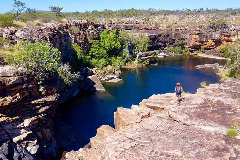
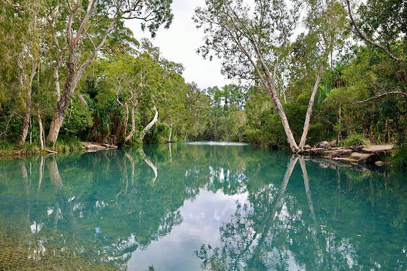
I decided to head further north and onto the very quiet Surveyors Pool, and eventually up to Walsh Point where I was told the track down was pretty ordinary. Arriving at Surveyor’s Pool carpark, I saw I was the only one there and, the added bonus, there were no noisy choppers in the sky. With a 30-minute walk up the pool and falls, I was blown away by the gorgeous Kimberley scenery and it was hard to imagine this placed in full flood. Laying in the cool water at the top of the falls for an hour, I heard the chatter of some visitors so I thought it would be a good time to leave.
ALL QUIET AT WALSH POINT
The road further up to Walsh Point was rough, but not as severe as I was told back at Drysdale River Station. Before dropping down to the lower parts of Walsh, several lookouts gave the most breathtaking views across into the Admiralty Gulf waters. Dropping down the last section into Walsh Pool, I saw I was the only camper around, so it was straight to the premium area with stunning water views surrounded by old boab trees.
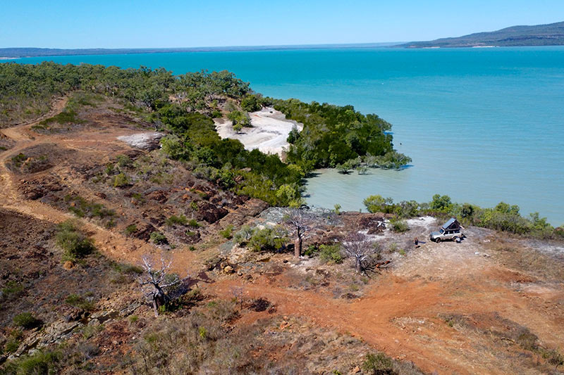
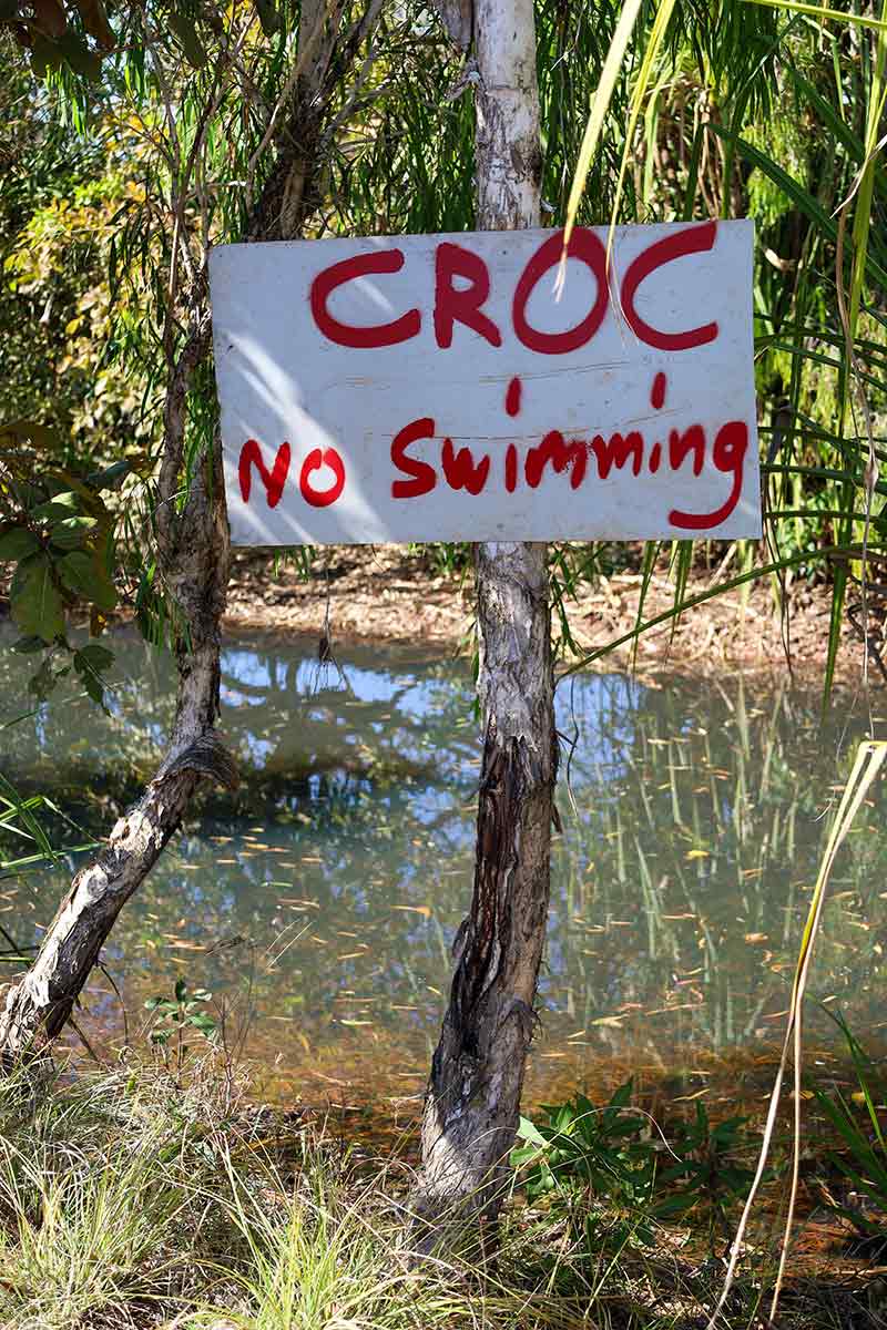
Now, apart from getting to this remote and isolated part of Western Australia, my plan was to hunt down a few barra and to enjoy the serenity after the visitor chaos back at Mitchell Falls. The sunsets were some of the best I had ever seen in the state, with beautiful boab trees as a backdrop, crocs and sharks cruising past camp at high tide, and yep, I caught several barra up to 700mm in length. Enough fish for a week.
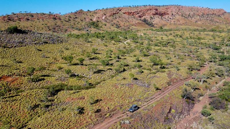
After a week at Walsh Point, with a few fish and plenty of memories under my belt, it was time to leave and head back out and further north to Kalumburu. It’s 100km back to the Gibb-Kalumburu Road turn-off and another 110km to the top to Kalumburu. Previously, I’ve seen a few shows where trucks tackle this road north and have all sorts of trouble, with the road looking more like a track with plenty of water crossings, over ranges and across a variety of different terrain.
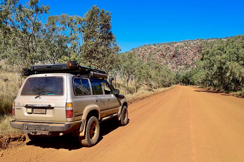
With this in mind, I swung a left back at the main intersection and headed towards Kalumburu. I wasn’t disappointed with what the drive showed me: water crossings, bird-filled billabongs, amazing views at the top of several ranges, and diverse wildlife along the way. Of course, this is still croc country so there was no way I could stop for a cool dip.
INCREDIBLE KALUMURU
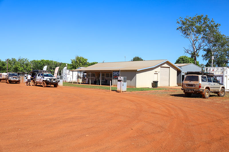
Arriving in Kalumburu, my first stop was for fuel, but being short on volunteers there was no fuel for sale on the day I was there. There’s a local shop that had a good supply of supermarket items and this is the place to get a permit to travel through town and onto the two camping areas further north. Keep in mind that Kalumburu is a dry town and no alcohol is available or can be drunk in town.
Kalumburu is the most northern settlement in Western Australia and was home to several Aboriginal groups for thousands of years. In recent years, other groups have moved in. This corner of Australia was one of the main points of entry for our first inhabitants and evidence of this, along with evidence of trading with Europeans, is highlighted in the rock art scattered throughout the north Kimberley, especially the Bradshaw paintings.
In 1905, a Catholic mission was set up at Pago, but in 1932 it was relocated to where Kalumburu is today as there was a more reliable water source. In Pago, you can still visit the crumbling ruins but need permission from in town to go on country. You can wander around the new stone mission and beautiful grounds today, and if you are lucky, the museum may be open.
Originally Kalumburu was called the Drysdale River Mission and it played a strategic role in World War II activities. Unfortunately, in 1943 the Japanese found this location and bombed the airfield and mission, killing six people. Later, the airstrip was moved further north-west, to the Anjo Peninsula. Remnants of the bombed aircraft can still be found today north of town. Planes are broken in half and gear is scattered through the bush. Finally, in 1954, a road path was surveyed and cut in to allow access to the town in the dry season.
After getting a permit and a few groceries, I headed further north to the McGowan Beach camping area. The other camping area, Honeymoon Bay, is another top spot but gets booked out pretty fast.
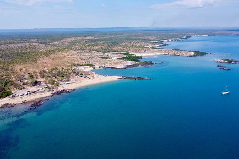
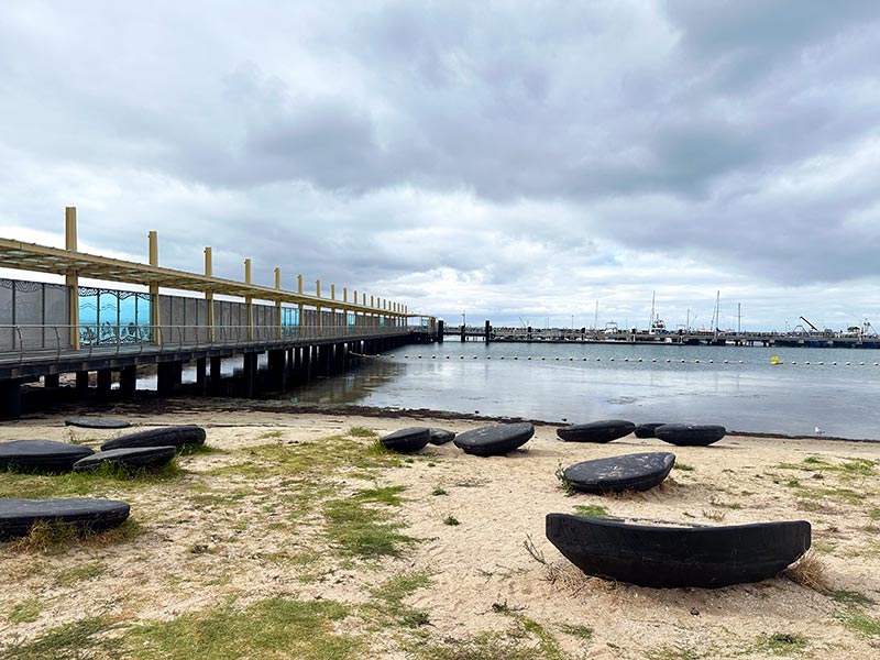
McGowan is tucked down on the coastline looking due west and it’s guaranteed that every day will offer a stunning sunset. But, being croc country, this isn’t the place to swim and frolic in the ocean. The camp hosts have rules for discarding fish frames, too: either several miles out to sea, or an old quarry a mile away from campers – a precaution to keep the crocs away.
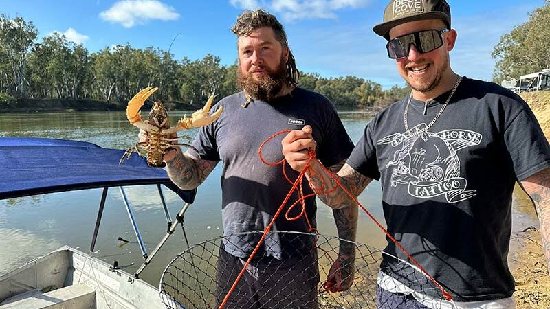
Fishing up here in the Top End is regarded as some of the best in Australia. Most days, there’s never a shortage of free fish to be handed around camp. McGowan also has basic laundry facilities, with Starlink offered for campers, fresh water and stunning ocean views.
After a week kicking back in the area, it was time to head back to civilisation, towards Wyndham, which was about 600km away. Syncing with Kalumburu’s fuel bowser open times and getting just enough diesel to get back out, I headed away from the Top End of Western Australia, over the wild and magnificent landscape. The drive out was just as impressive, across flat-top hills that were once joined to the Mitchell Plateau and where bauxite can be found.
The landscape has been broken down over millions of years, leaving amazing rock formations, carving ancient riverbeds and gorges into one of the most isolated places in Western Australia. This is one place that needs to be experienced at least once in your lifetime.
KALUMBURU FAST FACTS
WHERE
Kalumburu is at the very top of WA, the most northern town in the north-east of the Kimberley region. Once called the Drysdale River Mission, it;s an extremely remote and isolated town on the King Edward River and, more often than not, is isolated during the wet season. It’s about 200km north of Drysdale River Station, and it can take a good four hours to drive it due to the road’s condition.
LOCAL HOT SPOTS
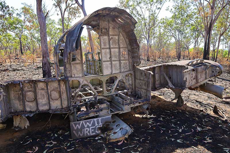
Being part of the amazing Kimberley region, the natural beauty will have you spellbound. From stunning waterholes through to amazing rock art and desolate beaches with gorgeous sunsets, this area is a naturalist’s dream. There’s history around town, including WWII plane wrecks, walks to local rock art, the mission’s museum, plus some of the best fishing that our country has to offer.
WHEN TO GO
The best time to head to Kalumburu is during the winter months, when tourists and keen fishermen spend weeks at a time in the area. Kalumburu has a small caravan park behind the mission in town, and there are two other camping areas north, namely McGowan Beach and Honeymoon Bay.
The local shop has a great range of supermarket items and this is also where you can get your permit to pass through town. Fuel is available on Wednesdays and Saturdays between the hours of 8am and 10am.
The post Kalumburu Touring Guide! appeared first on GoRV.
Source: https://www.gorv.com.au/kalumburu-touring-guide/