Doing The Duncan Road
After a big stint in Western Australia, I was hesitant to leave the amazing Kimberley region. After exploring so much of the north-west, I knew I had to leave soon as the daily temperatures were climbing. Crossing the border into the Northern Territory and watching the edge of the Kimberley fade in my mirror, I was hoping something would draw me back.
I was about 10 minutes into the Northern Territory when I saw a sign south to Halls Creek and the Buntine Highway. Always looking for an adventure, and with a quick scope of the map to see what was south, and I was confident that it looked good to explore. The leading signs said that Halls Creek was nearly 450km away but this was a remote and isolated area where travellers proceeded at their own risk.
DUNCAN ROAD IMPRESSIONS
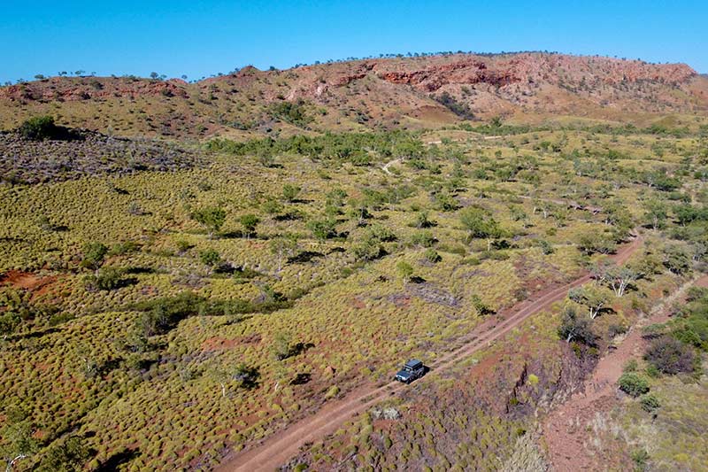
I found the conditions of Duncan Road to be like any other outback road. It was in pretty good condition, it was easy to drive after dropping some air out of my tyres, and it offered the most stunning scenery.
The Duncan Road was originally cut through in 1949 to service remote cattle stations and for the transportation of cattle out of the area. It is an interesting road. It starts in the Northern Territory and crosses into Western Australia, back into the NT, and back again into WA where it meets the Buntine Highway.
I was expecting a nice drive through Savannah-type country but, honestly, this blew my mind. I was travelling on the eastern edge of the Kimberley region the whole way down, intersecting stunning mountains with million-year-old rock formations covered with spinifex.
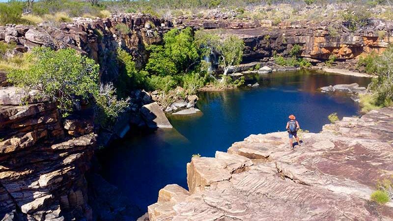
Heading down Duncan Road, I cam across several rivers and creeks that are safe for swimming, and some very nice rock pools and gorges where you can set-up camp for a night. Just respect where you stop and these places won’t be shut – it is private property all along the Duncan Road.
Halfway down, a huge rock cairn caught my eye. I discovered it was a memorial for the Ord River Regeneration Reserve. The project was to regenerate and stabilise some severely eroded sections of the Ord River catchment, which covered nearly 10,000 square kilometres. They fenced the area, removed feral donkeys and cattle, and reseeded the damaged, barren areas.
SAWPIT GORGE
I was bemused to see potential flood warning signs along the way, but after seeing some river and creeks and just how wide they get in flood season, it blew me away just how much water must flow through this area. Duncan Road ends at Nicholson Station at the Buntine Highway, where my journey would keep going west towards Halls Creek.
Heading west, and on the southern side of Purnululu National Park, the scenery is just as good. Mountains glisten in the sun, with with golden spinifex under huge white gums. Strangely, I saw no Kimberley boab trees along the way.
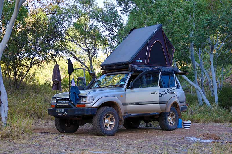
It’s only 170km to Halls Creek, but my camp for the night was Sawpit Gorge, 50km before Halls. There was a narrow, slow track into the gorge, where there are two camping areas near the Black Elvire River. With a towering rock wall on one side and sandy, shaded banks on the other where raging flood waters have cut a path, it’s a secluded and beautiful location to stop.
Free overnight camping is allowed – there is a toilet and rubbish bins at the top camp. The lower camp is 4WD-only, where camping is 10-fold beside the pools of water set amongst gums and the massive rock wall. At different times of the day, the sun lights up the wall with a stunning red show.
There are several walking trails along the creek to spot wildlife or just to find a private swimming hole. This place is beautiful and quiet.
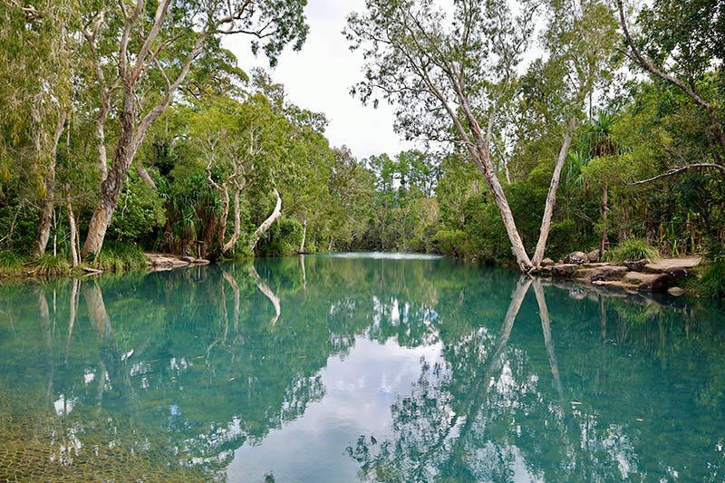
Back out on Duncan Road, a popular local swimming hole is Palm Springs. Also on the Black Elvire River, this palm-fringed spring-fed pool also allows free-camping. With permanent water, it’s truly an oasis where palms and soft grasses line the waterhole. It’s thought that Afghan teamsters planted the original date palms found here. One Afghan man, Sam Hazlett, and his Aboriginal wife, Duddru, lived at Palm Springs for many years, where they used the springs for drinking water and to grow vegetables that he sold locally.
HEADING TO HALLS CREEK
Not far down the road is Old Halls Creek, where the first gold was discovered in Western Australia and where the WA gold rushes began. It was in 1885 that Charles Hall found a 28oz nugget.
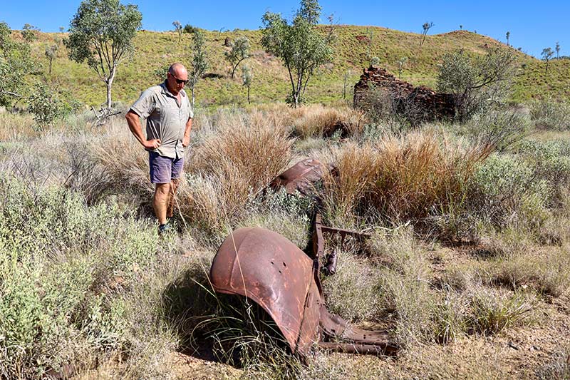
This area was known as the ‘Golden West’. Old Halls Creek was the site of the original gold mining community where prospectors followed the gold up the creeks and gullies from Brockman to Old Halls Creek. Today, some of the original mud buildings are protected from the belting sun and weather by a huge shed.
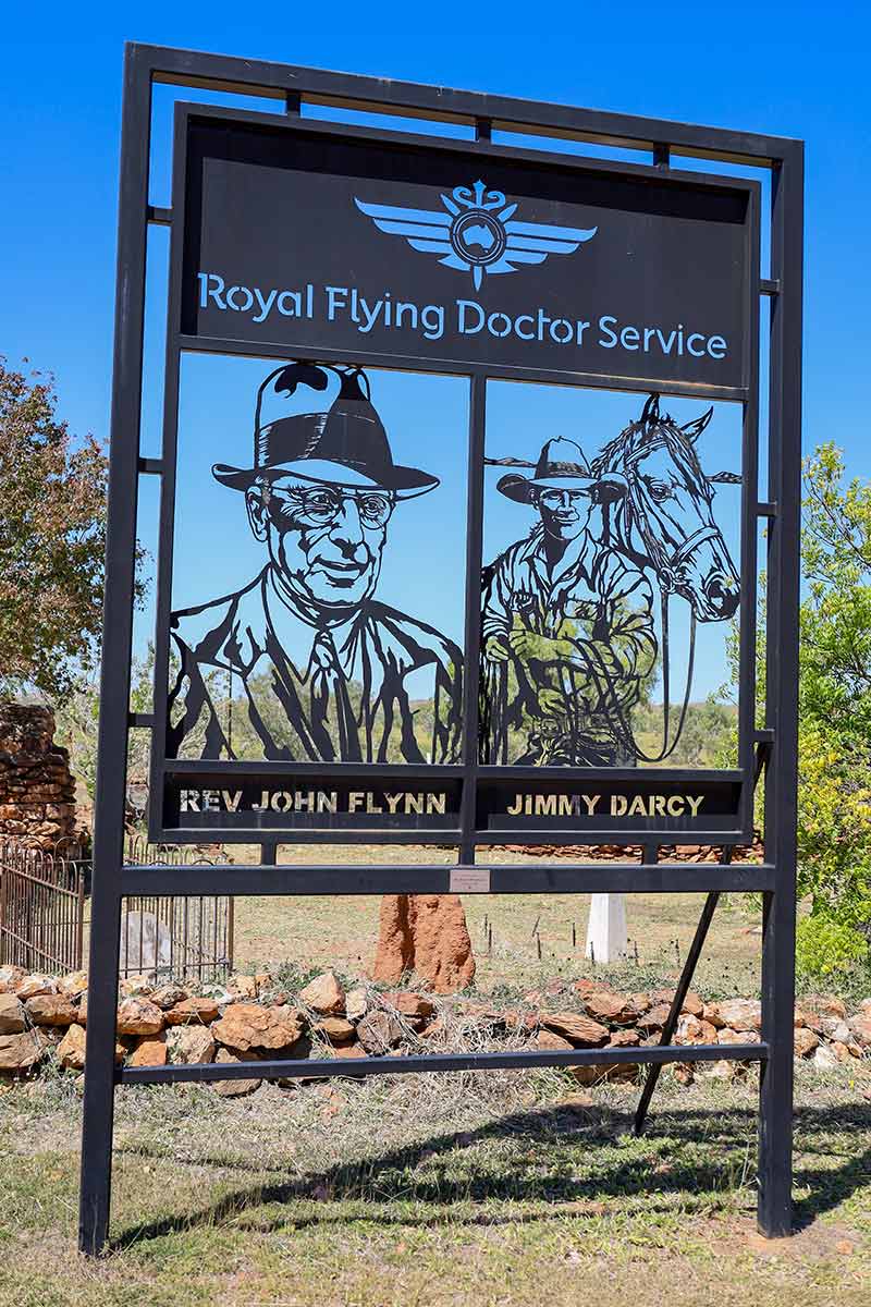
The 1885 gold rush was short and sharp here, but it bought people from the coast and from as far away as California. At its peak, the town had stores for commercial and private trade. Out the back of the old town is a memorial for the RFDS that was erected for its 90th anniversary, as this is the location where the idea for a remote doctor service originated. In July 1917, following the accident of stockman Jim Darcy, the Royal Flying Doctor Service was born.
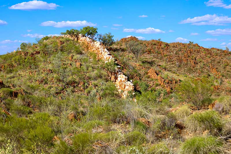
Further towards Halls Creek, a natural phenomenon in which softer rock has weathered away, leaving a striking pure white quartz wall rising up to 6m, has occurred. Called China Wall, the white quartz stands out as it carries on into the distance over several mountains and into the gullies. It’s said that this wall of quartz can be followed all the way north to Kununurra.
With nearly 500km under my belt, I needed to head into Halls Creek to fuel up, but not before finding a couple of old stone huts on nearby Sophie Downs Station.
 If you are in no rush and like getting off the main roads, driving through stunning scenery, setting up at amazing camp sites, then this explore is a no-brainer. With amazing history and dramatic landscapes following the Ord River, I personally consider the Duncan Road one of the most scenic roads in the whole Kimberley.
DUNCAN ROAD FAST FACTS
WHERE
Duncan Road is a 445km drive north-south on the eastern side of the WA border, from the Savannah Way to Halls Creek. With another 100km of side diversions, this is one great adventure drive. I found it full of amazing scenery and structures. The added exploration of Old Halls Creek and the stunning Sawpit Gorge was well worth the three-day detour.
WHAT TO SEE AND DO
Stunning landscapes on the eastern side of the amazing Bungle Bungle Range right down into the southern end, with camping at Sawpit Gorge and exploring the mud hut ruins of Old Halls Creek, plus the story behind the origins of the RFDS.
MORE INFO
Most relevant information can be found on the WA’s Kimberley map or atlas. A remote yet straightforward drive, it’s about the history and natural wonders. Road conditions can be found on both the WA and NT shire sites as Duncan Road wanders south through both states.
The post Doing The Duncan Road appeared first on GoRV.
Source: https://www.gorv.com.au/doing-the-duncan-road/