Navigation Advice: Find the Right Tools

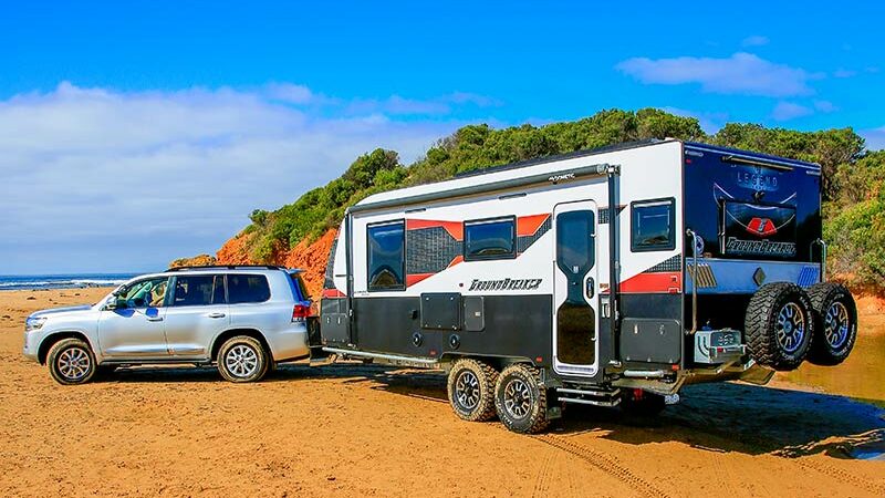
It would be fair to say that as a GoRV subscriber, you’re the type of person who likes to travel. But how do you work out where that next trip will take you? Questions such as, “How do I get to where I want to go?” and “How long will it take and have I got enough fuel?” can all be answered by using navigation tools. As to what navigation tools might suit you best, well, that’s going to depend on a few things. Let’s take a closer look at a few options.
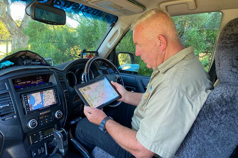
GPS NAVIGATION UNITS
Using GPS technology for navigation purposes would have to be the most dramatic change we’ve seen over the past 30 years. GPS stands for Global Positioning System, although it was originally known as Navstar GPS. Basically, it’s a satellite-based radio navigation system that doesn’t require internet coverage to work. For us road-based travellers, they make navigating much simpler. GPS units can provide users with turn-by-turn instructions to direct you to a location that’s been entered into the unit.
Many modern vehicles have units fitted as standard equipment, while an array of aftermarket units are available for those with older vehicles. Both styles can work well in built-up locations, although we’ve had the odd blooper here and there. Let’s just say being directed to go down a tight one-way street with a dead end ahead isn’t much fun when pulling a large caravan!
As far as aftermarket units go, products from brands such as HEMA, Garmin and VMS offer a navigation package that includes offroad mapping. They’re just like topographical paper maps, and these units allow you to navigate based on what’s around you. So they put you well and truly in the driver’s seat, so to speak, to make decisions on which way you might choose to go.
Among many of the great features these units have is the ability to drop a pin location and create a waypoint. This will save the coordinates onto the map that’s on the screen. You can then calculate distances, plan a route, and share these great spots with friends. The biggest challenge with GPS units is deciding which unit is right for you.
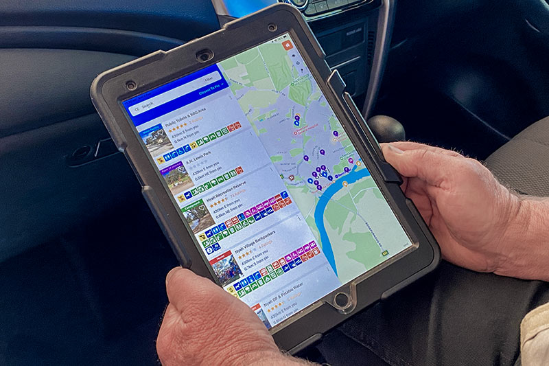
PHONES AND TABLETS
Similar to dedicated GPS units, phones, tablets and apps have opened things up in the world of navigation. But a word of caution: some app-based software may need a constant internet connection, which is fine in and around towns that have reception. However, if you venture beyond the black stump, you might just be looking at a blank screen.
This can be overcome in two ways. One is to ensure your device has an inbuilt GPS, and the other is to ensure the map you’ve downloaded in the app works offline. In other words, it doesn’t require an internet connection all the time.
This style of navigation can also offer a few software add-ons, such as photographing your location and placing it on the map. You can also import and export reference points simply by clicking through screens all on the one device.
Other benefits include being able to upload data to the cloud, as well as share locations with others using Airdrop, email or by sending a message. But as with everything, there are pros and cons. A benefit of these devices is they’re easy enough to use for route planning and trip organising anywhere, at any time. However, when used for vehicle navigation, where to locate the phone/tablet in your vehicle, and how to power them, can come with its own issues when compared to dedicated GPS units.
LET’S TALK APPS
The world of navigation apps is a biggie. And whether you’re an Android or iOS user, there’s certainly no shortage of different apps on the market. Some of these apps are free to download and use. Others might have a small initial purchase fee, whereas the more complex apps can have yearly subscriptions.
You’ll also find some apps can work offline, but they may require updates from time to time. This means you’ll need to reconnect to the internet to receive the update. It also pays to do some research on the app you’re considering purchasing, especially if you would like to keep records of where you’ve been. Also take note of where the app will store your mapping/travelling information and who can access it. This is a more prevalent topic when using subscription-based apps.
Some of these apps use crowd-sourced input data, meaning your location is being shared with others, which is something you might not want. One of the most popular navigation apps going around would be Google Maps. This app provides a range of features and is easy to use. Besides having comprehensive views of roads, terrain and satellite imagery, the app includes points of interest, turn-by-turn navigation, and live traffic updates. But, as we’ve found, Google Maps has flaws. In fact, it’s been known to lead RVers like us up the proverbial garden path. So we don’t rely on it alone for off-the-beaten-track travel, but find it’s a handy app when combined with other types of navigation tools.
PORTABLE GPS
A portable GPS is designed to be used anywhere. These units are typically smaller in size than an in-vehicle unit, and more robust since they’ll likely be exposed to the elements. Entry-level units come with small memory capacity and provide some basic GPS functions to get you going, while covering activities such as walking, cross-country hiking, and nautical navigation.
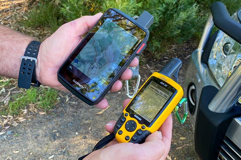
On the other hand, complex portable GPS units can do much more. Besides these units recording where you’re going, what you’ve seen (including taking photographs), and the time it took, they can record the topography and other analytics as well. In many cases, you’ll find the more advanced high-end units are usually subscription-based packages.
They have access to global software and offer a range of maps and styles. They generally have their own user communities where information can be shared between subscribers. A benefit of these types of units is many come with attachments for easy mounting to vehicles, bikes, boats, and the like. Or you can simply hang them off a backpack or belt using a carabiner-style clip.
However, these units can consume a chunk of battery power when a lot of their functionality is being used, so you’ll need to have a way to keep them charged.
PAPER MAPS
Perhaps we’re a little old school, but we’ll be the first to say you can’t beat an old paper map. Just opening it out onto a table really puts things into perspective and shows how big the country is. A paper map also allows multiple people to gather around to nut out a possible touring route together. They come in all sizes and scales, so you can expect the level of detail to range anywhere from displaying main highways only through to remote dirt tracks.
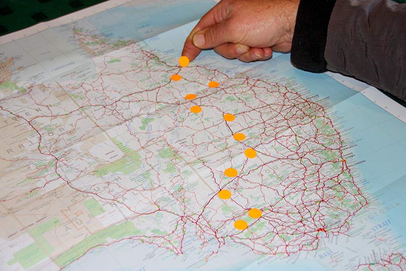
Specifically, topo maps are a good choice for travelling to remote destinations as they provide a lot of topographical detail. By using some simple maths and the map’s scale reference, you can easily calculate distances between the points on a map. We also like to carry an atlas while travelling. It’s quick and easy to flick through pages and join the maps together when chasing a route. Being a book-like version of a map, an atlas often comes with more narrative destination information as well.
Some atlases also highlight things like camps, caravan parks and points of interest. Unlike other forms of navigation, the trusty paper map and an atlas don’t run on battery power. And coupled with a compass, it’s possible to orientate where you are. While there is a range of gadgets and devices on the market to help you navigate, we feel the humble map still has its place.
SUMMING UP
At the very least, we need to acknowledge the early explorers who traversed this country all those years ago using the sun and stars to record the first handwritten maps of tracks and trade routes. These recordings formed the basis of the maps we use today.
Paper maps and GPS units allow travellers to explore beyond the mobile services of cities and large towns. Knowing how to read a paper map is a good place to start, along with having a GPS of some type. With these at your disposal, you’ll be in the box seat to decide where to go and how to get there… without getting lost.
The post Navigation Advice: Find the Right Tools appeared first on GoRV.
Source: https://www.gorv.com.au/navigation-advice/