New York Mixed Bag: Bass tournament reporting system now live – Outdoor News
Albany — New York’s new black bass tournament permit and reporting system is officially live. For tournaments that begin on or after January 1, 2025, tournament directors can now apply for black bass tournament permits via an online permitting system.
Black bass tournament permits are only required for fishing tournaments where black bass (largemouth bass and smallmouth bass) are the targeted species, and the tournament has 10 or more participants.
As part of this online system, a live, interactive map displaying where upcoming permitted tournaments will be held is also available. This map will not only help tournament organizers plan their events, but also help non-tournament anglers plan their outings.
DEC says having this system in place will help us understand the extent of tournament activity around the state and will ultimately help us manage and promote the quality bass fisheries that New York is known for. The link to the application can be found here.
MORE COVERAGE FROM NEW YORK OUTDOOR NEWS:
Black bear conflicts increase across New York this year
Mike Raykovicz: Tips you should know for crossbow safety
New York’s youth big game hunt coming up Oct. 12-14
River Creel Surveys Taking Place Again On The Saranac And Boquet Rivers
Plattsburgh, N.Y. — DEC recently announced the second year that river creel surveys will take place on the Saranac and Boquet rivers, both tributaries to Lake Champlain.
The River Creel survey is part of the salmon assessment and restoration efforts of the Lake Champlain Fish and Wildlife Management Cooperative and was preceded by a pilot survey program in 2023. The survey began Sept. 15 and will run through Nov. 30, and is focused on the Atlantic Salmon spawning runs on both rivers.
Information gathered will be used to develop a bi-annual river creel survey that will monitor the salmon fishery and inform management actions on these rivers. Anglers will be asked to voluntarily participate in the survey by providing information about their day of fishing. Collected data will include an angler’s preferred target species, the number of fish caught and harvested, and the angler’s satisfaction with the salmon fishery. If the angler allows, biological data will be collected from fish caught (length, presence of fin clips, number of sea lamprey wounds, and a genetic sample).
Locations include the Green Street angler access site and the fishing pool below Imperial Dam on the Saranac, and the area near Gilliland Park, in Willsboro, on the Boquet. A 2024 survey report will be released in Spring 2025.
Clear Lake Wildlife Management Area Dam Closed For Maintenance
Albany — New York State Department of Environmental Conservation has temporarily closed the Clear Lake Dam at the Clear Lake Wildlife Management Area (WMA) in North Collins, in Erie County. DEC Region 9 needs to complete scheduled construction involving rock maintenance on the earthen portion of the dam.
Construction began Sept. 16 and was expected to continue for up to three weeks. The entirety of the dam will be closed during construction. The rest of Clear Lake WMA and its reservoir will remain open and can be accessed from the WMA’s Genesee Road and Route 75 parking lots. DEC recommends those looking to launch canoes or kayaks to do so from the Genesee Road parking lot on the eastern side of the Dam.
The Clear Lake WMA comprises 525 acres of DEC land that offers hunting, fishing, trapping, wildlife viewing, and other recreational opportunities. It opened in 2020 as Erie County’s largest WMA.
DEC Rolls Out New Accessible Recreation Destinations Map
Albany — Saying that “enjoying New York State lands is for everyone,” The New York State Department of Environmental Conservation recently launched an Accessible Recreation Destinations Map designed to showcase wheelchair-accessible outdoor features throughout New York State.
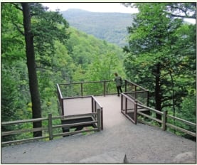
The map displays 266 recreational destinations in New York for people of all ages and abilities, including 84 locations with accessible boating facilities, 58 locations with accessible fishing facilities, 44 locations with accessible camping facilities, 50 locations with accessible hiking trails, 10 locations with an accessible beach access route, and 47 locations with accessible picnic facilities.
For more information, including descriptions and photo galleries of accessible boating, fishing, camping, hiking, and picnic facilities, visit the DEC website.
In addition to the map, information about accessible recreation has been refreshed throughout DEC’s website to ensure consistent and accurate information, so that everyone can enjoy our New York State lands. View the map here.
Source: https://www.outdoornews.com/2024/09/30/new-york-mixed-bag-bass-tournament-reporting-system-now-live/

