Lake Superior Provincial Park – RV Lifestyle Magazine

Cool, clear waters, sandy beaches, and stunning vistas!
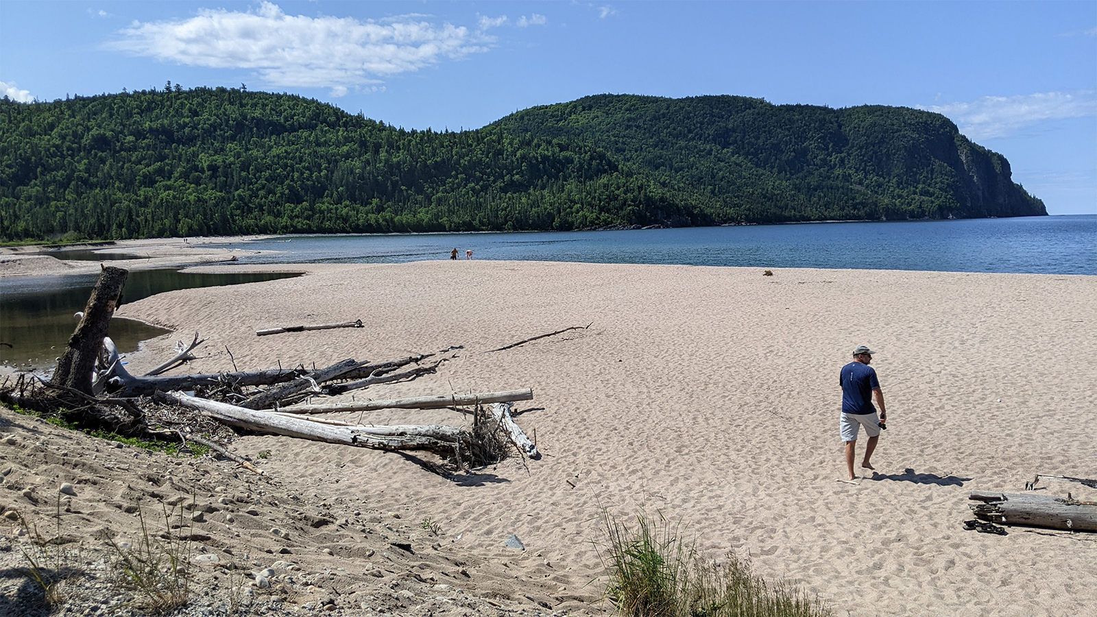
Beautiful fine sand, a blue sky with a few fluffy white clouds, the sun glistening off the calm, clear, deep blue water. To the left is hundreds of meters of gorgeous beach with a small point directing your attention to a tiny rock island. You race toward the water to get some relief from the heat. You splash through the shallow surf. Then it hits you. Shockwaves jolt through your body as you realize this is not the warm waters of the Caribbean, this is Lake Superior!
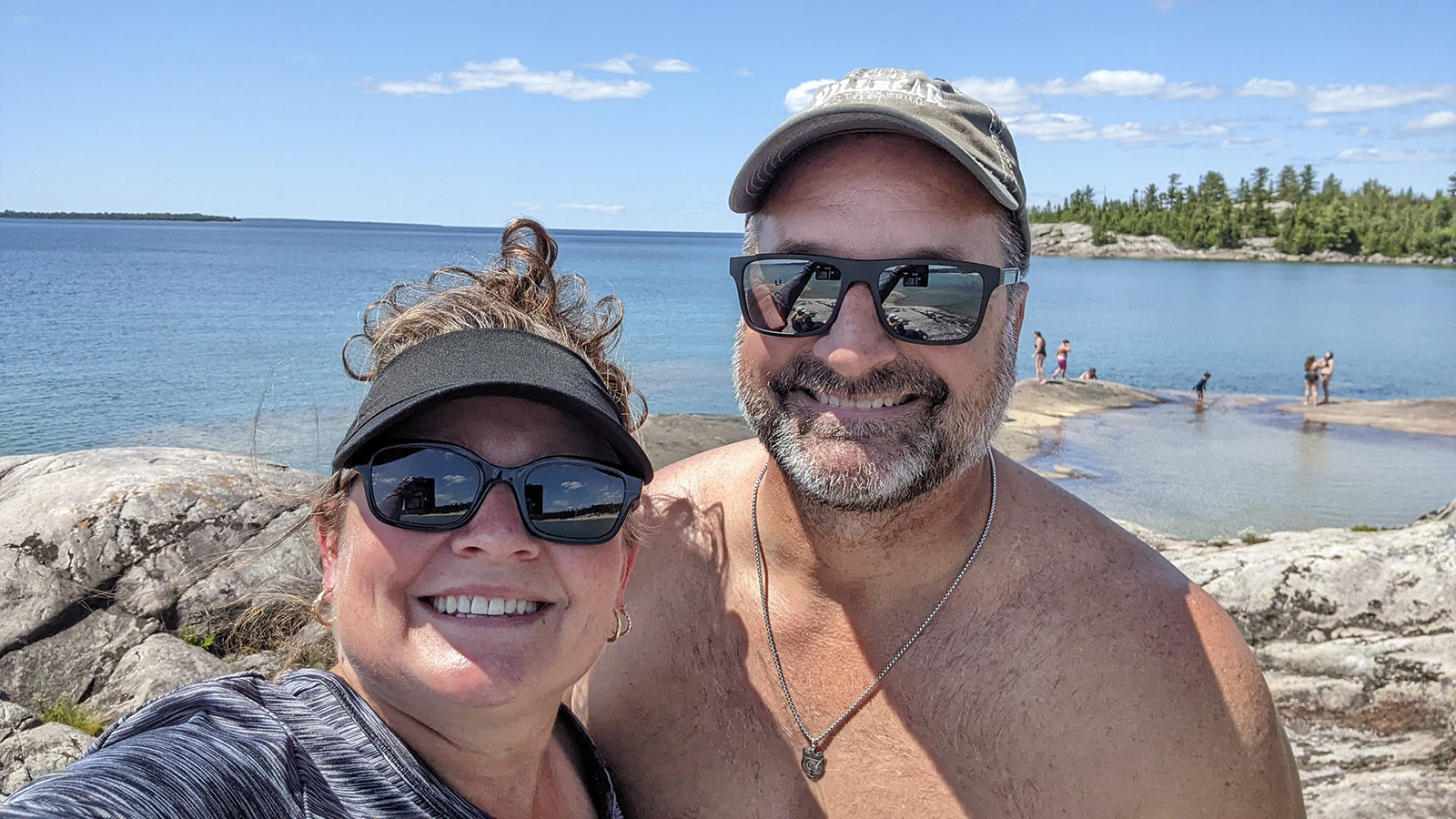
Lake Superior Provincial Park is one of those parks with so much to see and do that we absolutely recommend checking it out, if not once, several times to really be able to take it all in. On this July trip, which was our second ever stay at Lake Superior Provincial Park, we camped at the Agawa Bay campground. It has 147 campsites, 38 of which are electric sites with 30-amp hook ups and is right on the shore of Lake Superior with 3 km of beach made up of small, smooth, round rocks. We had an electric site right across the park road from the beach. The other campground at this park is called Rabbit Blanket and it’s 37 km north of Agawa Bay on an inland lake. The campgrounds are a small part of the experience in this park. To truly grasp the greatness of this place, you need to drive to other places within the park to explore.
Agawa Rock Pictographs
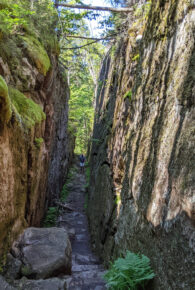
“Warning! Death and injury have occurred when highly unpredictable waves have washed visitors off the rock ledge while viewing the pictographs. Extreme caution is necessary at this site.” That’s the big, red, ominous sign we saw when beginning the Agawa Rock Pictographs Trail, our first hike of this trip. Located 9 km north of Agawa Bay campground, this trail is only 500 m, but it is still well worth the visit. We started down rock stairs, then to a lookout over Lake Superior, then down into a rock fissure, before making it to the cliff edge shore. As we hiked along the edge, that initial warning sign started to make sense. There were ropes secured to the rock at certain parts, to hold onto so you don’t fall into the surf or get swept away on wavier days. In order to get right up to the location of the pictographs, you have to shimmy across the rock ledge that slopes into the water. No ropes here. Cheryl chose to not risk it as I carefully went to the end to see the pictographs. The indigenous red drawings contrast with the white granite. Animals, canoes, mythical creatures. It makes me think of the people that were here long before today’s tourists.
Boat Launch
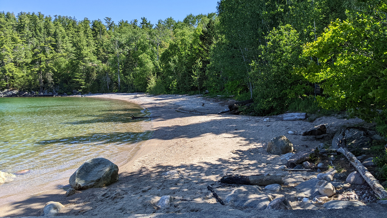
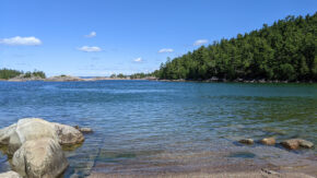
As we were driving out of the parking lot for the Agawa Rock Pictograph Trail, we saw a sign pointing to a boat launch. As part of our park reviews for YouTube, we often take pictures of the facilities including boat launches, so Cheryl ran over to quickly take a picture while I waited in the truck. After a few minutes, Cheryl hadn’t returned. I wondered what could be taking her so long to just take a picture of a boat launch. Did she drop her phone in the lake? I eventually went down to see what the problem was. “You’ve got to see this!” she called. She wasn’t kidding. This had to be the most beautiful boat launch I’d ever seen. It was located in a secluded little cove protected by rock outcroppings and islands. It even had a secluded little beach with no one around. We would have loved to have come back to spend some time there with our kayak and paddleboard, but we just didn’t have the time with so much to see and do in this park.
Pinguisibi Trail
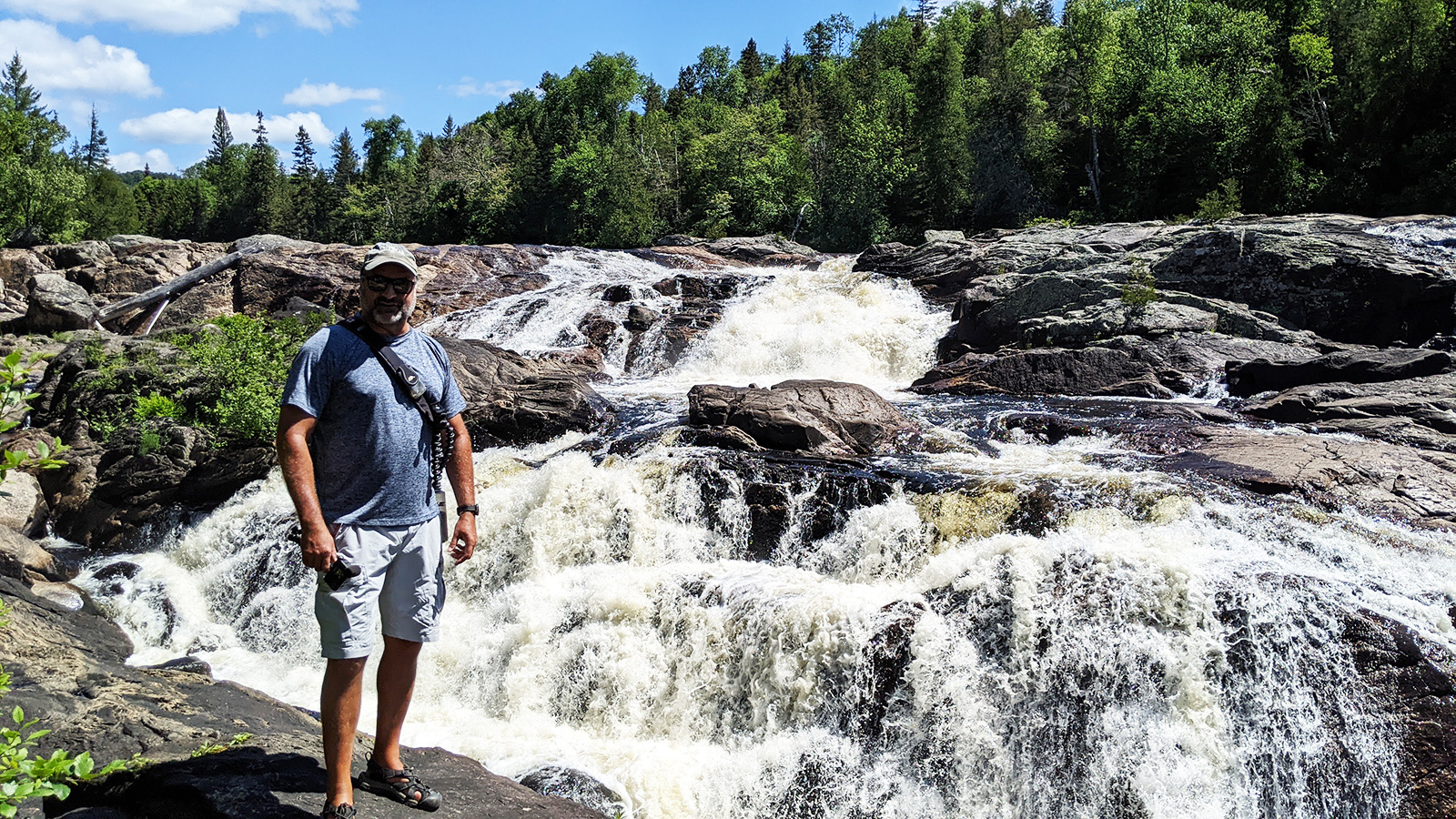
We then decided to drive another 7 km north to the Pinguisibi Trail. This is a 6 km linear trail following the banks of the rugged Sand River. It’s a fairly easy hike with incredible views of rapids and waterfalls the whole way. We hiked to Lady Evelyn Falls where we spent some time enjoying the beauty while having our packed lunch. There are plenty of dry rocks by the rapids to settle down with your food and enjoy the views.
Bathtub Island
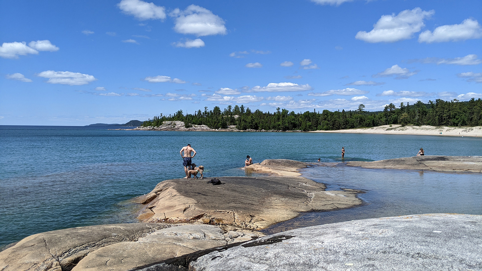
There is so much to do at this park, so of course we hit up another trail. We drove another 1 km north of the Pinguisibi Trailhead and pulled over to a rugged, unofficial parking lot on the west side of Hwy 17, a few hundred metres before Katherine Cove. It’s easy to miss, but luckily a couple of cars were already there marking the spot. We walked a small trail for just over 100 m before the trees opened up to a beautiful beach and Bathtub Island. Since this is a hike to an island and we didn’t bring our kayaks or paddleboard, we knew we were going to get wet. We walked along the fine sand to a point and then ventured into the water for the 100 m trek to Bathtub Island. The water only gets to a depth of about 2 ½ feet. Not too bad, right? Well, this is Lake Superior. AKA the coldest water I’ve ever felt without ice being in it. Our legs ached from the cold, and we couldn’t get to the island fast enough. According to Parks Canada, the yearly average temperature of Lake Superior is 4°C or 39°F. In the shallower waters near Agawa Bay in July, the water temperature may get a little warmer but for warm blooded people like us it’s still painfully cold. Once I climbed onto the sun warmed rock of the island, I started to get feeling back in my legs.
Bathtub Island earned its name because it holds warm water like a bathtub! It is a rock formation with an indention in the middle that goes below the water line. Waves break over the rock and fill the indention with water to a depth of about 3 feet. The sun then warms the surrounding rock and the shallow water in it. We walked into “the bathtub” and it certainly deserves its name. The warm water felt so good on my still very cold legs. Several kids and teens played in the bathtub while others walked around the small island. We settled on a high point of the island to sit and enjoy the view of the sandy shoreline stretched out before us in both directions. This day had to be one of the most scenic days we have ever had during any camping adventure. Eventually it was time for that cold walk back. After all, we had one more scenic view in store for the night: a campfire backlit by an epic sunset from the beach right in front of our site.
Old Woman Bay
The next day we drove 63 km to Old Woman Bay at the north end of the park. This is a must-see spot right off the Trans Canada Highway where many travellers stop for a break to take in the beauty. The sandy beach is deep and wide in this cove. If you look out at the water to the left, to the cliffs rising 200 metres up, the shape of an old woman’s face can be seen in the silhouette of the land mass and cliffs. After that view, we walked across the highway to hike the Nokomis Trail which is a 5 km loop. It is ranked among the top five-day hikes in the country, according to Lonely Planet’s “Discover Canada” guidebook and we can see why. This hike is rated as moderate difficulty, but in our minds, it was more difficult than that. It’s a steep climb through a boreal forest that takes you to some fantastic lookouts, including a lookout over Old Woman Bay. This is a great place to rest and grab a snack while enjoying the view. I would say that you should be in relatively good shape to hike this trail.
Lake Superior Provincial Park is a place that we have to go back to. Two trips to this park and we haven’t even scratched the surface of what it has to offer. We will definitely be back, but maybe next time in late August to give the water more time to warm up.
To see more about this trip, please check out our video: https://youtu.be/q5oLlHui7fw
 About Lake Superior Provincial Park
- Lake Superior Provincial Park – Hwy 17, Wawa, Ontario
- Open mid May to mid October
- Agawa Bay Campground
- 38 sites with 30-amp hookup and 109 unserviced sites
- 2 comfort station with flush toilets, showers, and laundry facilities
- 1 sanitation station
- Visitor Centre with a park store
- 3 km beach
- 1 on-leash dog beach
- Amphitheatre
- Canoe, kayak and SUP rentals.
- Rabbit Blanket Campground
- 20 sites with 30-amp hookup and 40 unserviced sites
- 1 comfort station with flush toilets, showers, and laundry facilities
- 1 sanitation station
- Amphitheatre
- Canoe, kayak and SUP rentals.
- 156 backcountry campsites with 8 access points for canoeing or hiking
- 8 canoe routes totaling 150 km.
- 11 hiking trails totaling 130 km.
- 3 beaches
- 1 boat launch
Post Views: 15
Source: https://www.rvlifemag.com/lake-superior-provincial-park/