Florida Bracing for ‘Ian’ Impact, Now Category Four Hurricane

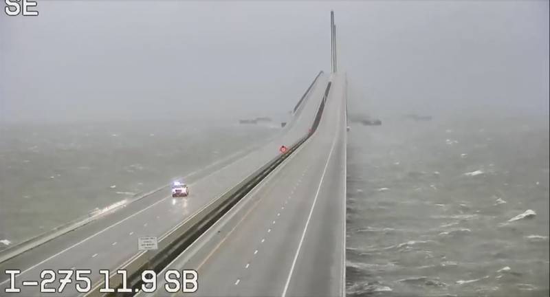
This image provided by FLDOT shows an emergency vehicle traveling on the Sunshine Skyway over Tampa Bay, Fla., on Wednesday, Sept. 28, 2022. Hurricane Ian rapidly intensified off Florida’s southwest coast Wednesday morning, gaining top winds of 155 mph (250 kph), just shy of the most dangerous Category 5 status. (FDOT via AP) (AP)
Hurricane Ian approached Category 5 status with sustained winds of 155 mph as it barreled toward Florida’s southwest coast this morning (Sept. 28) expected to trudge its way up toward Orlando tonight, according to the Orlando Sentinel.
At 9 a.m., the National Hurricane Center said the center of Ian was located about 60 miles west of Naples and 70 miles southwest of Punta Gorda and 185 miles south-southwest of Orlando moving north-northeast at 10 mph.
Storm surge from Englewood to Bonita Beach including Charlotte Harbor is forecast to hit from 12-18 feet. Surge up to 10 feet is expected north to Longboat Key near Sarasota and up to 12 feet south past Naples to the Everglades.
“Clearly, this is a very powerful major hurricane that’s going to have major impacts, both on impact in southwest Florida, but then as it continues to work through the state,” Gov. Ron DeSantis said from the state Emergency Operations Center in Tallahassee this morning. “It is going to have major, major impacts in terms of wind, in terms of rain, in terms of flooding, so this is going to be a nasty, nasty day — two days.”
Ian’s intensity increased to a strong Category 4 hurricane with maximum sustained wind of 155 mph and the NHC said conditions were rapidly deteriorating along Florida’s Gulf Coast with hurricane-force winds extending out 40 miles and tropical-storm-force winds out 175 miles.
“Tropical-storm-force winds already beginning to affect the coast,” the NHC stated. “Conditions will rapidly deteriorate and catastrophic wind damage is expected.”
Source: https://rvbusiness.com/florida-bracing-for-ian-impact-now-category-four-hurricane/


