Travel Guide: Fitzgerald River National Park

In a remote, unassuming corner of coastline between Albany and Esperance lies a national park of international renown, Fitzgerald River National Park (FRNP). In 2017, it was deemed a UNESCO-protected biosphere as 15 per cent of Western Australia’s plant species are found in the park, with approximately 75 species being found nowhere else on Earth.
Additionally, Fitzgerald River NP boasts the largest number of animal species of all parks in the south-west region of WA. Normally, such ecologically significant places would be off-limits to visitors, and while the central portion of the park is fully closed for conservation purposes and preventing the spread of dieback, the eastern and western parts are accessible to experience much of the unique flora, interesting geology, and beautiful coastline that this park has to offer.
HOPETOUN
Coming from the east, the town of Hopetoun, which offers a great 48-hour free camp for self-contained vehicles or a lovely caravan park by the beach, is a great place to stock-up on supplies and explore the beautiful beaches along the Southern Ocean Drive. From there you can enter the park along Hamersley Drive, the only sealed road in the park.
The other option for entry to the eastern side is from the north via the unsealed section of Hamersley Drive off the South Coast Highway, but the corrugations can be brutal. Campers have the choice of setting up at the national parks campground at Four Mile Beach or a campground further west at Hamersley Inlet, which is run by the Shire of Ravensthorpe.
LOOKOUTS AND BEACHES GALORE
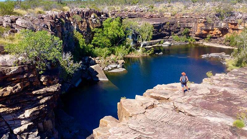
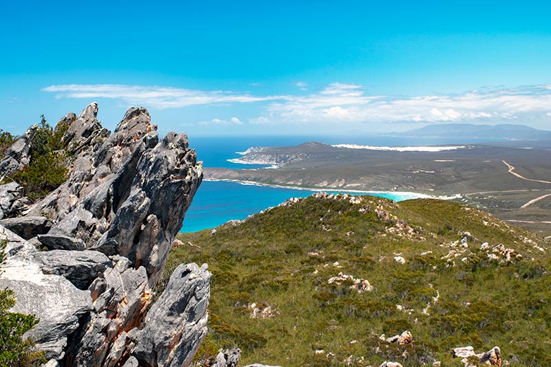
There are numerous lookouts to choose from on this side of the park; Barrens Lookout is a quick and easy option to get some good views but for the more active, the climb up East Mount Barrens is a must-do.
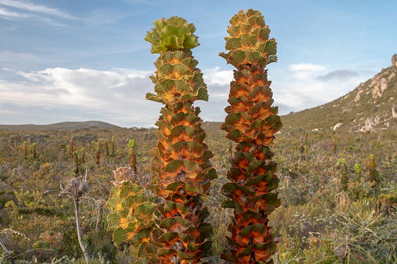
The path starts with a short boardwalk winding through some of the unique flora of the park, such as the royal hakea, which resembles a tall tower of stacked cabbages and, during springtime, colourful bursts of wildflowers including the Barrens regalia, which is found only in the immediate vicinity of East Mount Barrens.
From here, it’s a sweat-inducing scramble to the top, where you will likely see a few of the local Napoleon skinks scurrying about, and the jaw-dropping views from the top are more than worth the effort. It is the best spot in the park to watch the sunset; just make sure you have lighting to make your way safely down!
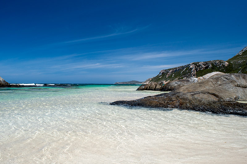
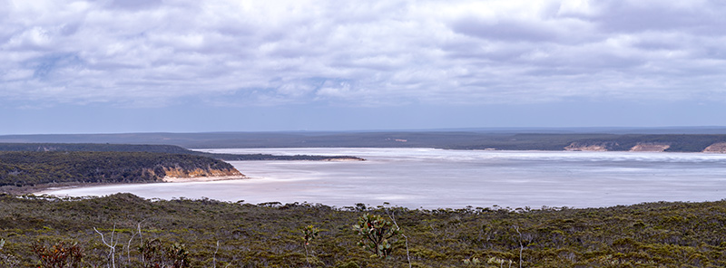
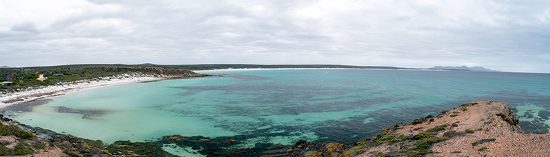
For when the weather is optimal, this area has some stunning beaches on offer. Barrens Beach and Four Mile Beach have the best swimming and snorkelling opportunities on this side of the park. West Beach is a great spot to see up close some of the unique geology of the Fitzgerald region, such as pelitic schist, which looks like it has glitter mixed through it, and folded rock with colourful bands. Cave Point has great views looking back east along the coastline.
4WD FUN IN FITZGERALD RIVER NP
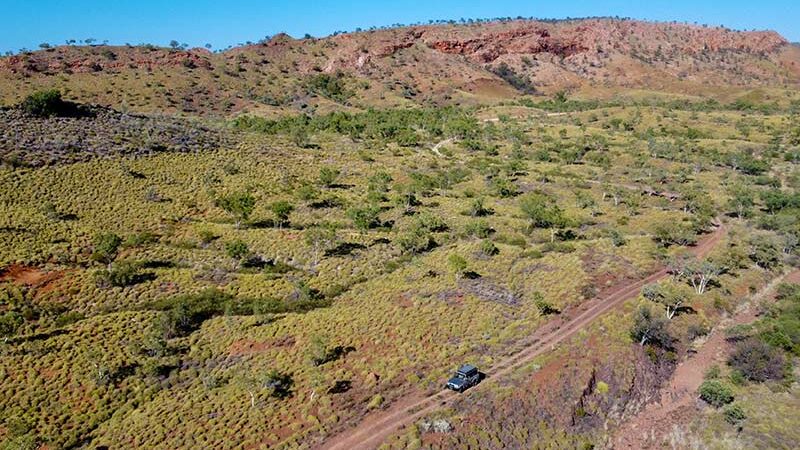
Surprisingly for a UNESCO park, there are some great 4WD tracks for those with the appropriate setup, i.e., a high clearance vehicle with good offroad tyres.
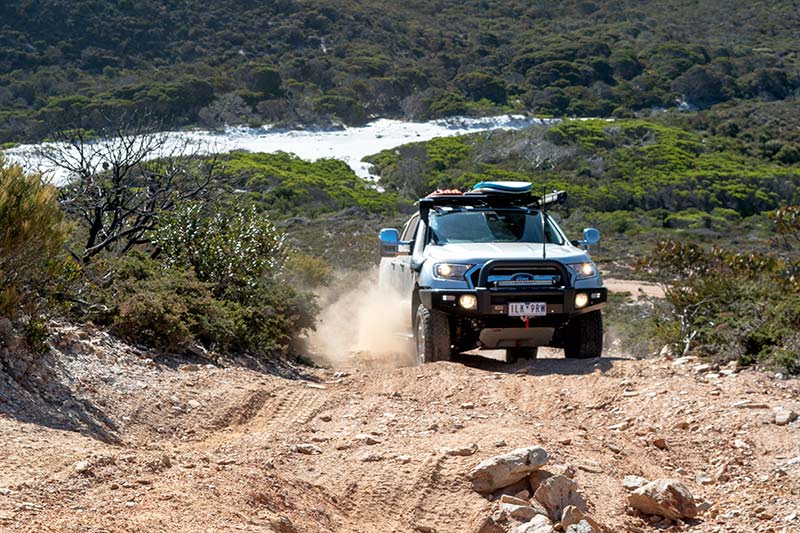
Continuing from East Mount Barrens north along Hamersley Drive, it’s about another 15km before the turn-off to Quoin Head Track on the left. As you head further into the centre of the park, a set of peaks begins to arise from the surrounding bush, part of the Barrens Range. The track stays fairly easy, albeit a bit narrow, for a while until you reach a set of large washouts, and the track began to earn its ‘4WD-only’ status.
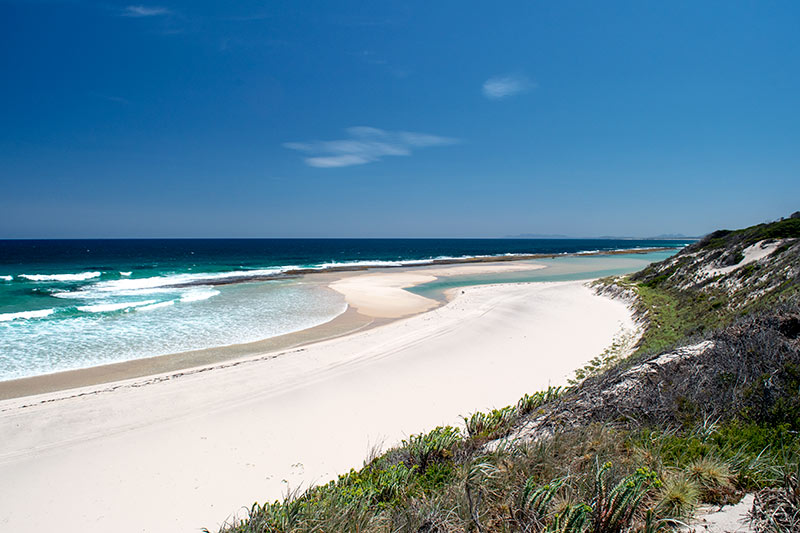
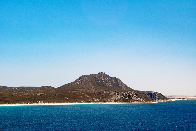
After getting through those, you are rewarded with the jaw-dropping beauty of the remote FRNP coastline: thick rolling bushland suddenly giving way to jagged, rocky cliffs dropping off to the clear, turquoise blue waters below. Up ahead looms the unmissable Quoin Head, so named due to its shape resembling a quoin, or a wedge used on olden ships to raise or stabilise the cannons.
The track winds back and down steeply along the gravel road, requiring care to control the decent, before finishing at a day-use area overlooking a pristine white sand beach with the ‘quoin’ towering in the background.
There are other 4WD tracks that are usually available to explore more of the eastern section of the park, such as a track off Quoin Head Track that leads to the picturesque Hamersley Beach and dunes, but they can be extremely narrow and scratchy. Tracks may be closed to help prevent the spread of dieback (see below).
WESTERN FITZGERALD RIVER NP
Once you have had your fill of the eastern end of the park, it’s time to check out the western side, which involves a detour since there is no access through the central section of the park.
Head west on the South Coast Highway, turning south at the town of Jerramungup, which has a large caravan park in town, or continue on to Quaalup Homestead, which has RV-friendly camping, whilst exploring west FRNP. Close by is Twertup, where you can walk amongst ancient and colourful spongolite, a type of sedimentary rock almost entirely made up of the ‘skeletons’ of sea sponges from when an inland sea existed.
For those keen for overnight hiking, the Mamang Walk is a 31km return walk from Point Ann to Fitzgerald Inlet, but many of the highlights can also be reached on a day trip. Point Ann, the starting point for the trail, provides great views over Point Charles Bay, a perfect spot for whale watching in the winter months.
After walking east along St Mary’s Beach, the track turns inland towards Lake Nameless, a large inland salt lake. The lookouts provide a good opportunity to rest and admire the terrain but by far the best views are at Point Charles Lookout, which looks out over Fitzgerald Beach, with the most intensely turquoise water you’re likely to ever see, with the Barrens Ranges as a backdrop.
 From here you can either make your way to the walker’s camp, which leaves much to be desired in regard to general upkeep but makes a good spot to rest for the night, or you can head back to Point Ann, where you may be lucky enough to be kept company by a pod of dolphins as you walk along the beach.
As you can see, Fitzgerald River National Park has something for any nature lover: scenic bushwalks, 4WD excitement, and beachside relaxation. And with a bit of extra care from everyone, hopefully we can keep this special park pristine and beautiful for future generations to enjoy.
DIEBACK DISEASE
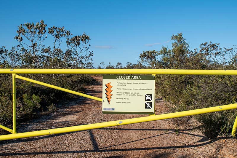 What is Dieback?
Dieback, or Phytophthora cinnamomi, is an invasive species of water mould that can quickly spread through local flora in an area by causing root rot.
This disease is very effective in killing plants, which impacts the local wildlife that depend on these plants for survival, thus decimating a region’s biodiversity. There is no cure for dieback, and it is very difficult to eradicate once introduced to an environment as it can lie dormant in soil for long periods of time. Therefore, the most effective management strategy is preventing its spread.
How can you prevent the spread of dieback?
- Wash your walking shoes before every walk;
- Clean the underside of your vehicle regularly;
- Stay to marked tracks; and
- Obey road/trail closed signs.
The post Travel Guide: Fitzgerald River National Park appeared first on GoRV.
Source: https://www.gorv.com.au/travel-guide-fitzgerald-river-national-park/